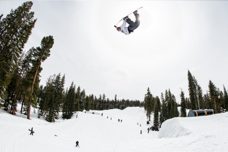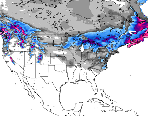
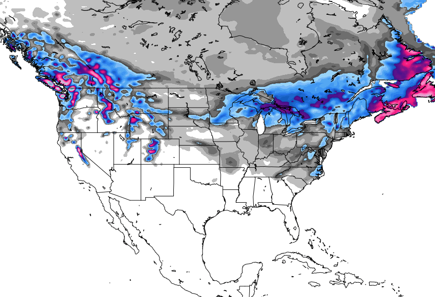
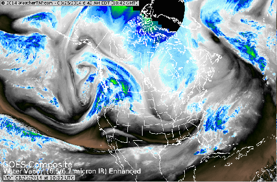
March may be coming to a close, but winter certainly isn’t over. From East to West, the snow is still falling, with huge totals projected for the PNW and the Sierras, while more mild but still respectable accumulations hit the Midwest and the Northeast. Check out full forecasts for every region, courtesy of the big brains over at opensnow.com.
The Pacific Northwest
The snow is stacking up in Washington as a solid 26 inches will grace Mt. Baker‘s slopes by Saturday. Stevens Pass could see up to 23 inches, while Crystal Mountain can expect up to 20. Across the state, snow will be falling on and off through Saturday, with Sunday dropping just about 1 inch on Crystal Mountain, 49 Degrees North and Mt. Baker.
Oregon is sitting pretty as well, with 20 inches of new snow predicted to hit Mt. Bachelor by Friday, before Saturday comes with high hopes for 38 inches at Timberline. Mt. Hood Meadows is expected to receive up to 23 inches Friday and Friday night alone, with totals by Saturday morning expected to reach 38 inches. Across the PNW, hefty snowfall can be expected throughout the rest of the week and into the weekend, though things appear to mellow out for most places around the beginning of April.
Colorado
After a heavy dose of snowfall Wednesday night, things will mellow out briefly before kicking back into high gear as a system comes in Thursday night and into Friday. Saturday will be dry out again, before another round of light to moderate snow swings through Sunday and again on Tuesday night. Wednesday and Thursday’s showers will target Steamboat, Beaver Creek, Cooper, and the west side of Vail, with less snow east of Vail Pass towards Summit County. Crested Butte, Monarch, Irwin and Aspen will also benefit greatly, with accumulations projected to reach into the double digits over Wednesday night, though Thursday’s storm may not reach these areas.
Though snow is expected across the state over the end of the week and into the weekend, Wednesday night will be the highlight for the Southern mountains — think Telluride, Silverton, Durango, Wolf Creek— so Thursday morning should be primed and ready for some powder turns.
For more info, check out the Colorado Daily Snow
The Sierras
The snow is back in Tahoe, as Wednesday brings 6-9 inches to the mountains on the East side of the lake, 9-15 inches to the West side of the lake, with up to 18 inches along the crest by Thursday morning.For the mountains along the West and the crest, the snow will continue on into Thursday, lingering on through Saturday morning. For lower elevations, a cold front will push through on Saturday and into Saturday night, dropping similar accumulations to those brought by Wednesday’s storm. After the air clears on Monday morning, showers are expected to return Monday evening through Tuesday morning.
Utah
Spring shredding in full force! Utah is projected to experience snowfall on-and-off Wednesday and Thursday, with 6-12 inches expected to stack up in the northern mountains by Friday while 4-8 inches accumulate in the southern mountains. Friday and Saturday are expected to warm up before Sunday, which brings the promise of another storm and a few inches of powder.
Click here for the full forecast
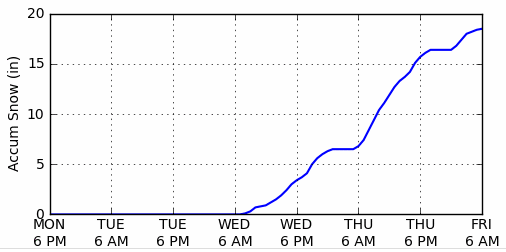
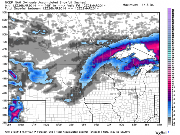
The Midwest
Unfortunately for the Midwest, a system that had been expected to bring snow has actually brought slush and rain back to the region. The early evening and overnight hours of Wednesday will bring rain, before a warm front moves in on Thursday all the way through Minnesota and Wisconsin right up to the Duluth area, bringing with it a lovely mixture of rain and sleet. On the other side of the warm front, however, there is a promise for a nice little snow storm, and it looks as though the North and South shores could see between 4-8 inches, while 2-4 inches are expected for the UP. Things will warm up across the region this weekend, with temps jumping into the 50s by Saturday afternoon.
Need more details? Andrew Murray has you covered
The Northeast
Things are pretty quiet up in the New England area, as Wednesday brings heavy winds, and very cold throughout persist throughout the week. There will be some accumulating snowfall right at the coast, but not near any resorts, unfortunately. As the storm moves out, snow is expected to hit Northern VT, Northern NH and Western Maine, leaving behind a few inches of new snow. Temps will warm up into the weekend, with rain showers projected for Friday.
For more info, check out the New England Daily Snow
The Northern Rockies
Farther west, in Montana, snow is expected to fall pretty consistently throughout the rest of the week, with Yellowstone Club and Big Sky seeing 19 and 18 inches, respectively, by the time Sunday rolls around. For its part, Sunday is looking to be a solid day across the state, with up to 6 inches falling at Whitefish Mountain, Showdown Mountain, Red Lodge Mountain, Montana Snowbowl, Big Sky, Blacktail Mountain, Bear Paw and Discovery, with another 6 inches projected for Tuesday, and a third round for Thursday. Lost Trail Powder Mountain and Maverick Mountain and Yellowstone Club will not only earn their 6 inches on Sunday along with the rest of the state, but are also expecting up to a foot of new snow Tuesday, while the other resorts see just around half a foot.
Over in Wyoming, inches are stacking up as well, with Jackson Hole looking at 24 inches over the next 5 days, while Teton Pass and Grand Targhee take a close second with 23 inches. On Sunday alone, 6 inches are predicted for White Pine, Teton Pass, Snow King, Sleeping Giant, Jackson Hole and Grand Targhee.
In the same boat as WY and MT, the entire state of Idaho is projected to see consistent snow for the rest of the week. Brundage is projected to see 27 inches over the next 5 days, the biggest totals— up to 10 inches— coming over Friday night. The forecast calls for 24 inches at Bogus Basin, as Sun Valley enjoys 15.